 Marrakech Guidebook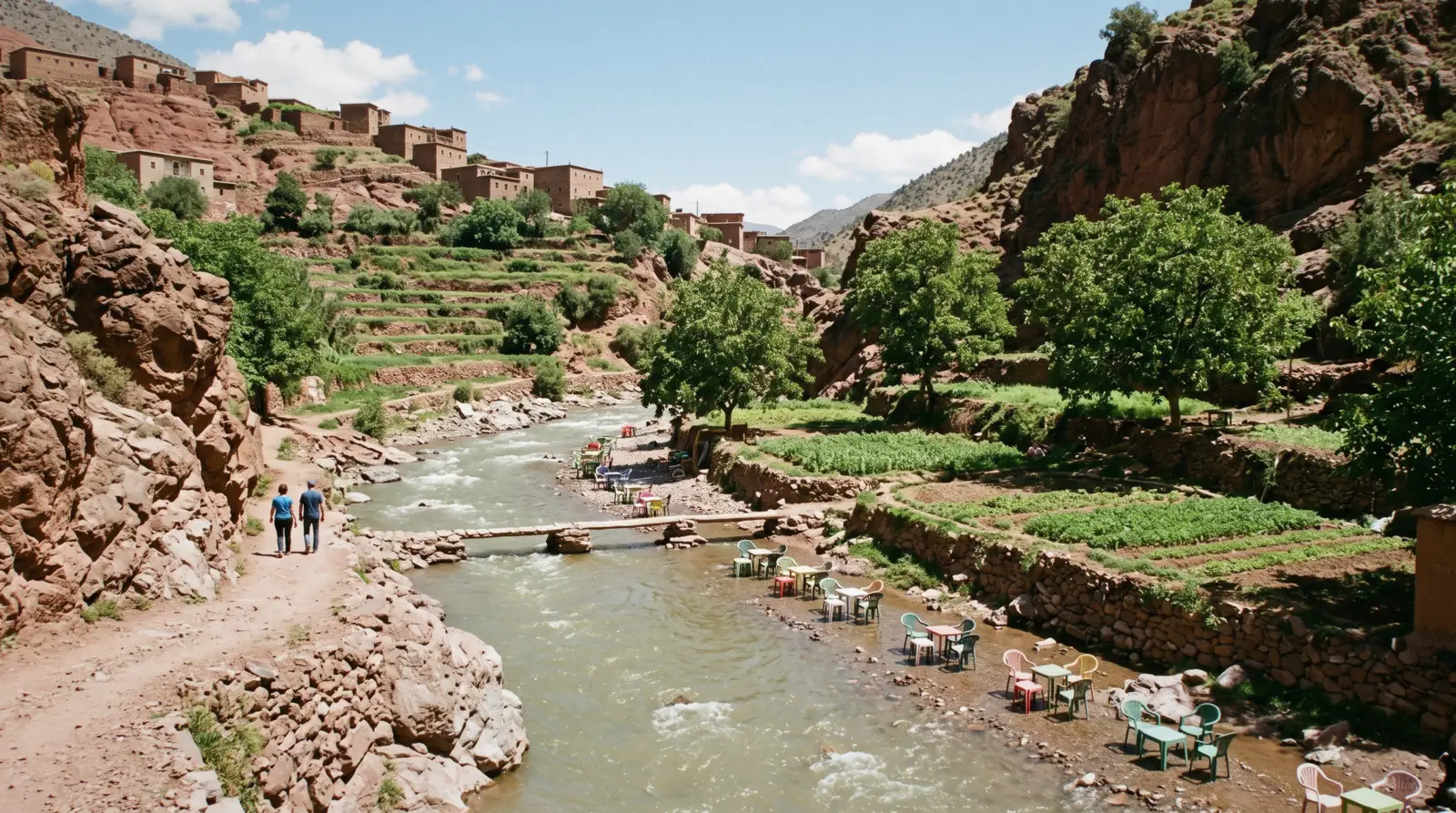
Ourika Valley
The Ourika valley is the river valley that runs south from Marrakech into the first wall of the High Atlas, ending at the village of Sti Fadma, written Setti Fatma on every road sign, where a path climbs to seven waterfalls. This page carries the road, the real distance, the cost of getting up it and the flood record that shapes where you sit down to eat. The wider list of destinations is on the day trips page, and the city itself is on the Marrakech guide homepage.
Quick answer Distance, cost, the waterfalls and the one real hazard, in three lines
Setti Fatma sits at kilometre point 59 of route provinciale RP 2017, so it is 59 km from Marrakech and not the 30 to 35 km repeated online, which describes the lower valley. Nothing is ticketed: no authority publishes an entry fee, an opening hour or a permit for the valley or the waterfalls.
Key takeaways
- The cost is transport, not admission. A guided day with lunch and the waterfall hike is listed at $13.27, and the alternative is a shared grand taxi with no published fare
- The hazard is the river, not the path. The wave of 17 August 1995 rose in ten minutes and killed 289 people, and floods here happen in every month except December, with a quarter of them in summer
- Two hours of walking gets you past the third of the seven falls at Setti Fatma; the rest is scrambling. If you want mountains rather than a river, Imlil is the other valley, and every destination is compared here
Key facts
Opening hours
| Open country on a public road. No gate, no ticket office and no published opening hours | |
|---|---|
| Waterfall path at Setti Fatma, unmanaged and unlit | daylight–dusk |
Closed None published. The road is cut only when the river is in spate
Admission
- Adult
- Free. No Moroccan authority publishes an entry fee for the valley, for Sti Fadma or for the seven waterfalls
- Reduced
- Not applicable, there is no ticket
- Free
- Everything. What you pay for is the drive, the lunch and, if you want one, a guide on the waterfall path
Planning it
- Time needed
- Not stated by any authority. Our routing: seven to eight hours door to door from Marrakech, of which about three are on the road
- Book ahead
- Recommended — a few days
- Address
- Sti Fadma (Setti Fatma), kilometre point 59 of route provinciale RP 2017, Cercle de Tahannaout, Province d'Al Haouz
Nothing here is a ticket, because nothing in the Ourika valley is ticketed. What the table compares is the three ways up the road and what each one costs, read from GetYourGuide in Q3 2026 and from the Moroccan tourist board's own valley article, which publishes no fee of any kind.
Are you paying to see the valley, or paying not to organise the day?
| Option | What it costs | Includes | Cancel | Book |
|---|---|---|---|---|
| Go yourself, there is no ticketAnyone with a car, or a group of four willing to negotiate a taxi for the day | Free at the valley; you pay only the vehicle | No gate, no fee, no permit published for the valley, Sti Fadma or the falls | Nothing to cancel | Official site |
| Guided day with the waterfall hike and lunchFirst-timers who want the waterfall path walked with someone who knows where it stops being a path | $13.27 listed | Return transport, guide, lunch, about seven hours | Free up to 24 hours before | Check Availability |
| Ourika waterfalls and Atlas foothills with guide and lunchAnyone who wants the valley plus the Atlas foothills in one run and does not mind a longer day | $17.80 listed | Return transport, guide, lunch, seven to eight hours door to door | Free up to 24 hours before | Check Availability |
The operator of the $13.27 trip states that its transport permit covers international tourists only, not Moroccan residents, which is the sort of condition that surfaces at the pickup rather than at checkout. Listed prices move with the date; treat the card figure as the one you pay only once the checkout shows it.
Ways up the Ourika valley, compared
Three products that end at the same riverbank. Prices are the GetYourGuide listings read in Q3 2026, in US dollars as the platform shows them; ratings and review counts are the platform's own.
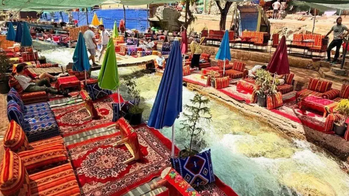 from $13.27
Marrakech: Ourika Valley lunch & guided hike to waterfalls
listed at $13.27
Seven-hour Ourika Valley day trip with a guided hike to the Setti Fatma waterfalls and lunch, in a small group. The operator's transport permit covers international tourists only, not Moroccan residents.
Check Availability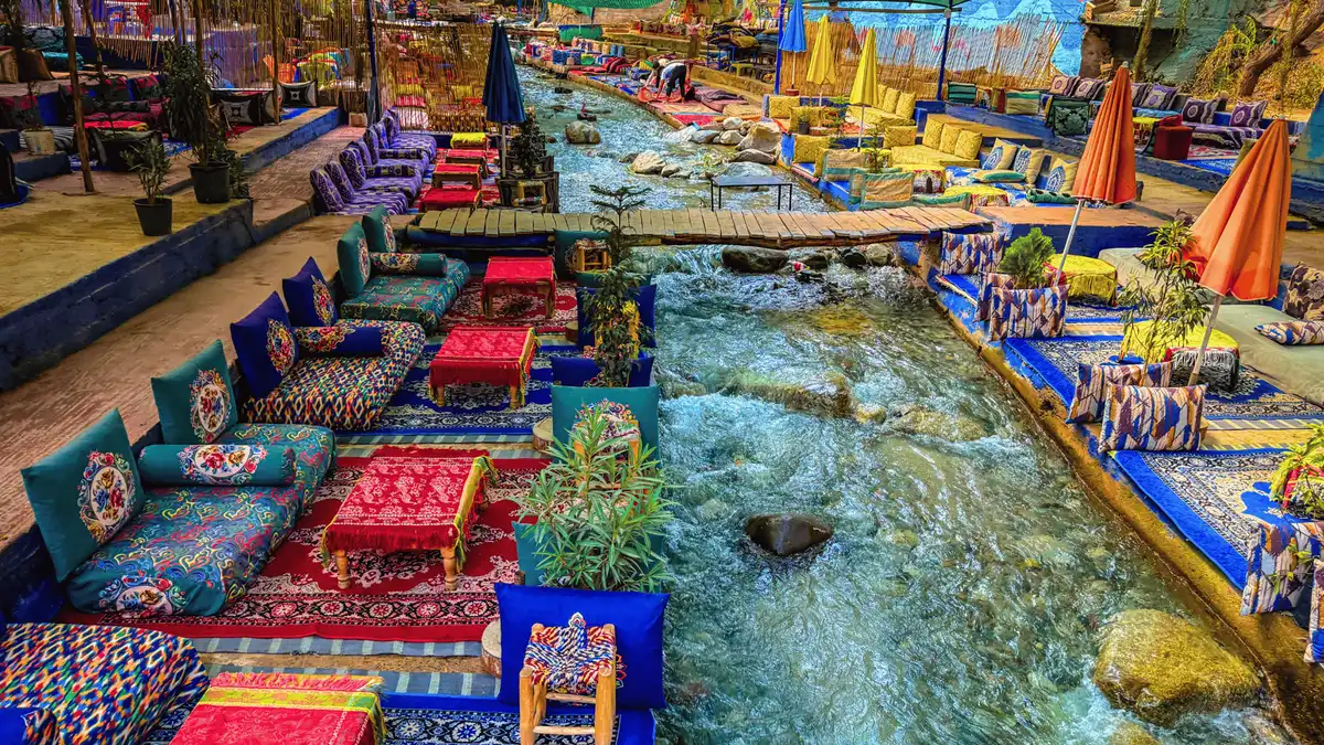 from $17.80
Marrakesh: Ourika Waterfalls, Atlas Mountains, Guide + Lunch
listed at $17.80
Seven-hour trip to the Ourika waterfalls and the Atlas foothills with a guide and lunch, pickup details sent by WhatsApp the evening before. Counting transport, plan on seven to eight hours door to door.
Check Availability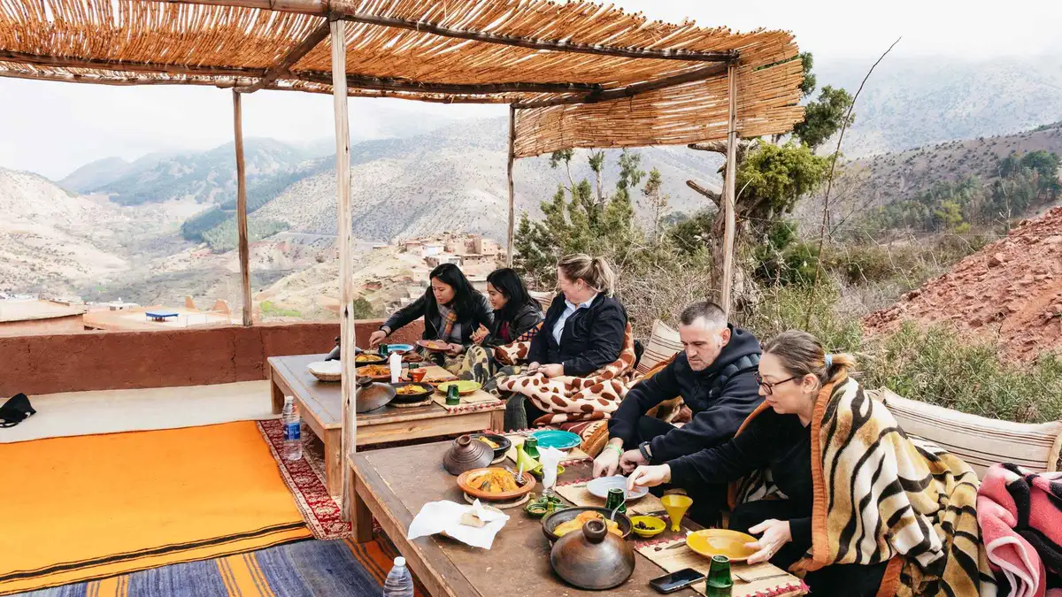 from $80.20
Marrakech: Atlas Mountains and 5 Valleys Day Tour with Lunch
listed at $80.20
Eight-hour drive through the Atlas foothills and five valleys with stops for tea and lunch, pickup included. More driving and viewpoints than walking.
Check AvailabilityPrices, ratings and details are the platform's own, checked in Q3 2026; dollar figures are the listed prices — the platform bills in your account's currency.
The road is RP 2017, and Setti Fatma is 59 km away
Two facts on this page contradict most of what is written about the Ourika valley in English, and both come from the same document: the 2023 road-traffic register published by the Moroccan Ministry of Equipment and Water through its national roads study centre, CNER.
The valley is served by route provinciale RP 2017. It is not the R203. The R203 is the Marrakech to Tahannaout to Asni regional road, which serves a different valley and ends at the Toubkal trailhead.
Guides that route you up the Ourika on the R203 have merged two valleys that never meet, and the mistake matters the moment you are following signs at a junction.
The second correction is the distance. Setti Fatma sits at kilometre point 59 of RP 2017, so the road distance from the edge of Marrakech is 59 km. The 30 to 35 km figure in circulation is real but describes the lower valley around Tnine Ourika, which is where the road first meets the river and where a lot of day trips actually stop.
Read as one road with three counted sections, it looks like this.
| Section of RP 2017 | Kilometre points | Length | Vehicles a day, 2023 |
|---|---|---|---|
| Marrakech to the Al Haouz boundary | PK 0.00 to 16.80 | 16.80 km | 14,916 |
| Al Haouz boundary to Tnine Ourika | PK 16.80 to 34.00 | 17.20 km | 8,361 |
| Tnine Ourika to Sti Fadma (Setti Fatma) | PK 34.00 to 59.00 | 25.00 km | 6,666 |
| RP 2010, the parallel road from Tahannaout | whole route | 51.00 km | 3,545 |
Those counts answer the other question people ask, which is whether the road is open at all after the 2023 earthquake. A counting post does not record 6,666 vehicles a day on a closed road. The traffic is also the reason the valley feels crowded: almost all of it is day traffic from the city, arriving in the middle of the day and leaving before dark.
The valley itself is not one commune but three. Sti Fadma, the commune at the head of the valley, had 24,159 residents at the 2024 census in 5,162 households. The lower commune of Ourika had 50,558, including an urban centre of 24,056.
Oukaimeden, the ski commune over the ridge, had 4,790. The whole of Al Haouz province had 642,815.
Road numbers, section lengths, kilometre points and annual average daily traffic from the CNER Recueil du Trafic Routier 2023; population from the HCP legal population, 2024 census. Both read for this guide in Q3 2026.
The Ourika Flood Record, In Nine Lines
The valley's own history is a hydrological one, and it is unusually well documented because a Moroccan basin agency has been gauging this river for decades. Every line below comes from that record.
-
2 November 1987
A first documented peak
The Aghbalou gauge records a peak of about 650 cubic metres a second on a river whose mean flow is 5.3.
-
17 August 1995, 20:00
Thirty cubic metres a second
An ordinary summer evening on the river, with the streamside cafes of Setti Fatma full. Rainfall over the upper basin is later estimated at 100 mm an hour for two hours across 228 square kilometres.
-
17 August 1995, 20:10
One thousand and thirty
Ten minutes later the same gauge reads about 1,030 cubic metres a second. The rise time of the flood was ten minutes and it lasted three hours, moving 3.3 million cubic metres of water.
-
The morning after
289 dead
The count recorded by the Direction Provinciale de l'Agriculture de Marrakech: 289 deaths, 194 houses destroyed, 83 vehicles swept away, 210 hectares of farmland lost and damage of about fifteen million dollars. The figure of 730 repeated across the internet has no official backing anywhere.
-
28 October 1999
A retaining wall fails
Peak 762 cubic metres a second, fifteen houses destroyed, and a wall built after 1995 gives way.
-
14 November 2000
The basin agency is created
Decree 2-00-479 establishes the Agence du Bassin Hydraulique du Tensift, which takes over gauging and warning on the Ourika.
-
2003
The Oulmass alert post goes in
The agency installs the first alarm post in the valley. On 4 August that year, 50 mm falls in ten minutes and the warning is given 45 minutes before the wave.
-
29 August 2006
The sirens work, and two people still drown
Peak 286 cubic metres a second. Residents reach the refuges after the sirens sound, but two people are swept away and about fifty cars are damaged. The main road is cut.
-
Now
Five stations and thirty minutes
The pilot early-warning system runs five automatic stations in the upper basin at 1,270, 1,650, 1,850, 2,200 and 2,230 metres, two VHF relays and an alarm station with loudspeakers, with annual evacuation drills. Warning lead time has gone from six hours to thirty minutes.
Discharges, dates and the death toll from Saidi, Daoudi, Aresmouk, Fniguire and Boukrim, Les crues de l'oued Ourika, Comunicacoes Geologicas 97, pages 113 to 128, a peer-reviewed paper co-authored from inside the Tensift basin agency; the warning system from the agency's own flood pages and the JICA study of the Ourika forecasting system. Read in Q3 2026.
When the Ourika floods, and why the standard advice is wrong
The UK Foreign Office tells visitors that heavy rain causes flash flooding in the mountains and near rivers 'during winter months'. On this river that is not what the record shows, and the difference is the whole of the summer season.
Floods on the Ourika occur in every month of the year except December. Forty-four per cent of them fall in spring and twenty-five per cent in summer, produced by intense convective storms over the high basin rather than by winter rain. The disaster of 1995 was in August.
So a visitor reading only the winter warning arrives in July confident that the season is safe, which is precisely the season in which one flood in four happens.
The mechanism is simple enough to plan around. The basin above the Aghbalou gauge covers 503 square kilometres, rises to 4,001 metres and averages 2,500 metres, and mean rainfall goes from 541 mm a year at the gauge to over 700 mm on the summits. Water falling up there arrives down here fast, on a narrow floor with one road and, in places, crossings built to be driven through rather than over.
What that means in practice on a day out. The riverside restaurants of Setti Fatma set their tables on platforms and boulders in the streambed, which is the whole charm of the place and also its risk. If it is raining hard up-valley, or the water is browning and rising while you sit, the correct response is to leave the streambed, not to finish the tagine.
The loudspeakers are there because that judgement has been wrong before.
For scale, the gauge record gives a flood of about 103 cubic metres a second every two years and about 485 every ten. The everyday river is 5.3. Nothing about the valley on a clear September morning suggests those numbers, which is why they are worth carrying up the road with you.
Seasonality and recurrence intervals from the peer-reviewed Ourika flood record cited above; the quoted advice is the UK Foreign Office Morocco travel advice, which names neither this valley nor Setti Fatma anywhere. Read in Q3 2026.
Setti Fatma and the seven waterfalls
The waterfalls are the reason the coaches come, and they are the one part of the day nobody manages, prices or supervises.
The path starts behind the village, crosses the river on boulders and planks and climbs on the left bank. The first fall is roughly half an hour up for most people, the third about an hour beyond it, and the seventh is a scramble that turns into route-finding on loose rock. Almost everybody stops at the first or the third.
There is no ticket, no barrier, no marked grade and no rescue point, and after rain the crossings are the difficult part rather than the climb.
Men wait at the bridge offering to guide you up. Nothing published shows that they hold the carte professionnelle and badge that Moroccan law requires of a licensed guide des espaces naturels, and no authority publishes a rate for the walk, so the price is whatever is agreed at the bottom. Agree it before you start, in dirhams, for the whole party and for the return, and be clear which fall you are being taken to.
A guided day trip solves this by having the guide already paid.
Footwear decides the day. The rock is polished, wet for most of the crossings and slick under a film of dust in late summer. Sandals are the commonest reason people turn back at the second crossing.
The village itself is a strip of cafes and rug stalls along the road, and the ONMT calls it 'an extremely popular destination as it's a short distance from seven waterfalls that cascade from rocky outcrops above'. Two hours covers the walk and lunch; longer is a hike rather than a stop.
Guide licensing under loi 05-12, which regulates who may work as a guide and never obliges a visitor to hire one; the quotation is the Moroccan tourist board's own valley article. No tariff for a local guide, and no grading of the path, is published by any authority.
How to get to the Ourika valley, and what a tour actually saves
Three ways up, and only one of them has a published price. The comparison below sets what each costs against what it removes from the day, with the honest gap where no Moroccan authority publishes a figure.
Grand taxis for the valley leave from the Bab er Robb side of the medina. That is universally reported and it is not published: the Commune de Marrakech's transport pages carry nothing on grand-taxi stands or fares, and no province or ministry publishes a shared-seat tariff for this route. So the fare is negotiated, per seat if you wait for the car to fill with six, or for the whole car if you do not.
Anyone quoting you a firm dirham figure from a blog is quoting a guess.
| Way up | What you pay | Time door to door | What it removes |
|---|---|---|---|
| Guided day trip | $13.27 to $17.80 listed | 7 to 8 hours | The taxi negotiation, the lunch stop, the waterfall guide and the drive back after dark |
| Shared grand taxi to Setti Fatma | No published fare, negotiated per seat | About 1 h 30 each way, plus the wait for the car to fill | Nothing. You arrange the day yourself and set your own hours |
| Private taxi or car for the day | No published fare; agreed for the vehicle | About 1 h 20 each way free-flow | The waiting, and the return timetable |
| Scheduled coach | Does not exist | n/a | Neither Supratours nor CTM serves the valley; the Ourika appears in no coach network |
The free-flow driving estimate from Jemaa el-Fna to Setti Fatma is 62.7 km and about 1 hour 21 minutes, computed on OpenStreetMap data for this guide. Real running time is longer, because the last 25 km is a single valley road shared with 6,666 vehicles a day, and because the section through Tnine Ourika on a market morning does not move at map speed.
The decision, in one sentence: if you are two people without a car, book a trip, because the whole saving of doing it yourself is eaten by a negotiated taxi fare that nobody can tell you in advance.
Driving distance and free-flow time computed with the public OSRM routing service over OpenStreetMap data in Q3 2026; traffic counts from the CNER 2023 register. Carrier coverage checked against the official Supratours and CTM booking systems, neither of which lists a stop in this valley.
Five Things Most Visitors Do Not Know About The Ourika Valley
Each line is a fact we could source, with the source in brackets. Everything we could not source is marked as such elsewhere on this page rather than smoothed over.
- The road you are on is RP 2017, and the R203 that half the internet sends you up is a different road serving a different valley (CNER Recueil du Trafic Routier 2023).
- Setti Fatma is 59 km out, not 30 to 35; the shorter figure describes Tnine Ourika in the lower valley (CNER kilometre points on RP 2017).
- The 1995 flood killed 289 people, not the 730 repeated online, and the count comes from the provincial agriculture directorate (Direction Provinciale de l'Agriculture de Marrakech, 1999, in Saidi et al., 2010).
- The river rose from 30 to about 1,030 cubic metres a second in ten minutes at the Aghbalou gauge, which is why the modern warning system measures its lead time in half-hours (Saidi et al., 2010; Agence du Bassin Hydraulique du Tensift).
- One flood in four here happens in summer, so the standard 'winter months' flood advice does not describe this valley (peer-reviewed Ourika record; UK Foreign Office Morocco travel advice).
The negative findings matter as much: no Moroccan authority publishes an entry fee, an opening hour, a permit, a grand-taxi fare or a guide rate for the Ourika valley, and the commune of Sti Fadma has no website.
In The Ourika Valley: What To Do, And What Not To
Every line here is argued somewhere above, compressed into what you decide on the morning.
Do
- Leave early: the last 25 km of valley road carries 6,666 vehicles a day and nearly all of them arrive between 11:00 and 15:00
- Fix the guide's price at the bridge, in dirhams, for the whole party and for the return, before the first crossing
- Wear shoes with a grip, because the river crossings, not the climb, are what turn people back
- Watch the water, not the sky: browning, rising water is the signal to leave the streambed even if it is dry where you are sitting
- Take the guided day with lunch if you are two people with no car, because the DIY saving disappears into a negotiated taxi fare
Don't
- Don't navigate by the R203; that road runs up the Imlil valley, not this one
- Don't plan the day around reaching the seventh waterfall; the route above the third is a scramble with no marked grade
- Don't assume summer is the safe season here, because a quarter of the recorded floods happened in it
- Don't book a valley trip expecting high mountains, since the walking above the village is a river path and the High Atlas hiking is a different trip
- Don't take a dirham figure for the shared taxi from any guide, this one included; no authority publishes one
Ourika Valley map: the road, the village and the neighbouring valleys
Setti Fatma at the head of the valley, the valley floor below it, and the two other places people confuse it with. Coordinates are the Wikidata reference points for each site.
Pin coordinates are the Wikidata P625 values for Sti Fadma, the Ourika valley, Imlil, Toubkal National Park and Jemaa el-Fna, verified in Q3 2026.
Where to go instead, or next
The three destinations people weigh against the Ourika, with the one line that separates them.
Imlil
The Toubkal trailhead, reached on the R203 through Asni rather than on the Ourika road. Walking there starts at the village and goes up rather than along. The Imlil page has the road sections and the guide question.
A different valley, 64.8 km by roadAtlas Mountains
Toubkal National Park was created in 1942 and its own management plan disagrees with the environment ministry about how big it is. The Atlas page carries the refuge tariffs and the compulsory-guide question.
The range the valley cuts intoAgafay desert
Stone hills rather than a river, 35 minutes from the medina and sold as a desert. The Agafay page sets out what is actually there and what nobody publishes about it.
26.5 km the other wayOurika Valley questions
How far is the Ourika Valley from Marrakech?
Setti Fatma, at the head of the valley, is at kilometre point 59 of route provinciale RP 2017, so 59 km by road. The commonly repeated 30 to 35 km describes the lower valley around Tnine Ourika, where the road first meets the river. Free-flow driving from Jemaa el-Fna is about 1 hour 21 minutes and realistically longer, which is why the guided day trips run seven to eight hours door to door.
Is there an entry fee for the Setti Fatma waterfalls?
No. No Moroccan authority publishes an entry fee, a ticket, an opening hour or a permit for the valley, for Sti Fadma or for the seven waterfalls, and there is no ticket office to collect one. What costs money is the transport, the lunch and any guide you engage on the path. The ways up the road are compared above.
Which road goes up the Ourika Valley?
Route provinciale RP 2017, counted by the Moroccan roads register in three sections from Marrakech to Sti Fadma. It is not the R203, which is the Marrakech to Tahannaout to Asni road serving the Imlil valley; a parallel provincial road, RP 2010, runs 51 km from Tahannaout across to Tnine Ourika.
Is the Ourika Valley dangerous?
The road and the village are ordinary; the river is the hazard. On 17 August 1995 the flow at the Aghbalou gauge went from 30 to about 1,030 cubic metres a second in ten minutes and 289 people died. A five-station warning system with loudspeakers and annual drills now covers the upper basin, with about thirty minutes of lead time. Sit in the streambed by all means, and leave it the moment the water rises or browns.
Can you get to Setti Fatma by public transport?
Not on a scheduled coach. Neither Supratours nor CTM lists a stop anywhere in this valley. The practical independent option is a shared grand taxi from the Bab er Robb side of the medina, for which no authority publishes a fare, so the price is negotiated. A day trip with transport included removes that negotiation.
How long is the walk to the Ourika waterfalls?
About half an hour of boulder-hopping and climbing to the first fall for most people, and roughly another hour to the third. The seventh is a scramble on loose rock with no marked grade and no rescue point. Two hours covers the walk most visitors actually do, and shoes with a grip matter more than fitness because the river crossings are the hard part.
What is the best time of year for the Ourika Valley?
Spring gives the fullest waterfalls and the worst flood statistics, since 44 per cent of recorded floods here fall in spring and another 25 per cent in summer. Autumn is the compromise: the river is low enough for easy crossings and the valley is cooler than the city. December is the only month with no flood on the record.
Where the Ourika valley fits in a Marrakech trip
One line of routing, and the argument for it.
This is the day-four trip on a three-night city stay, or the day-two escape if the heat has beaten you. It is the closest real mountain landscape to Marrakech, it costs nothing to enter and the whole thing fits between breakfast and dinner. It is not a hiking day: the walking is a river path and it stops being one above the third waterfall.
If you want ridges, snow and a trailhead, go to Imlil instead. If you want a landscape with no river in it at all, the Agafay hills are 35 minutes out. If you are still choosing, every destination is compared on drive time and do-it-yourself fare, and the city list itself is on the Marrakech guide homepage.
The Ourika Valley On Film: The Road, The River And The Waterfall Path
Three walk-throughs that show what the day actually looks like, including the river crossings on the waterfall path, which is the part photographs flatten.
Ourika Valley Hike: The Best Day Trip From Marrakech? | Morocco Vlog Part 5
The full day from pickup to the falls, with the boulder crossings filmed rather than skipped.
Video: Family Travel JoyHiking Ourika Valley, a Marrakesh Day Trip
A walking-paced run up the waterfall path, useful for judging the footing before you commit.
Video: Jinan Ali ExploraGems of Ourika Valley (Day Trip), Marrakesh, Morocco
The valley floor, the riverside tables and the village strip, which is the half of the day the hiking videos leave out.
Video: Sandie FITNASSVideos load from YouTube only when you press play.
Reviewed Q3 2026 (July–September 2026); next review Q4 2026. Prices, hours and terms are set by the venue or operator and confirmed at checkout.
We may earn a commission if you book through one of our links, at no extra cost to you. Full affiliate disclosure